Ratnagiri Settlement Study
- a21devesh
- Nov 18, 2022
- 2 min read
The module began with a settlement study of Sadamirya village at Ratnagiri on the Kokan belt of Maharashtra. On reaching the site, the students were divided in 5 groups which studied village on a broader aspect to understand the economic-cultural relationship of the village. The five groups were: Village, Economy, Construction, Houses, and Cultural.

I was in the Village Group which had to map the whole village. was in Village group.
We were asked to study and measure a piece of land, with sea on one edge and the a Mahapurush temple on the other hand. We saw a variety of contrasts between people, spaces, accomodation techniques and roads. We started with measuring the village site with a standard stride (approximately 1 meter) and started measuring the dimensions of the village. We took 2 anchoring points, the main road where the temple of Mahapurush was and the road which ran by the coast. We marked the roads in between them. They ran into homes and backyards and front yards and again merged with each other. At first this all was very confusing for us.
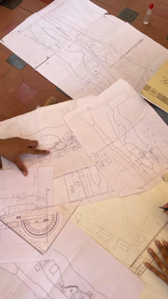


After marking all essential things on the map around all the small roads and ways which ran through the village, we started marking the trees and houses around them. The stories and gossips those people living in the houses had and how it formed a village and a community together. We marked all the coconut trees which helped in forming cultural spaces, even the slightest coconut tree's bark was drawn on the sheet.
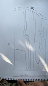
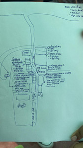
The drawing below was our final map of the Mirya village my group members & I drew.

Team Members:
Kankana C.
Rishab D.
Parth K.
Aashika T.
Parth A.
Lavanya N.
Soham L.


Comments